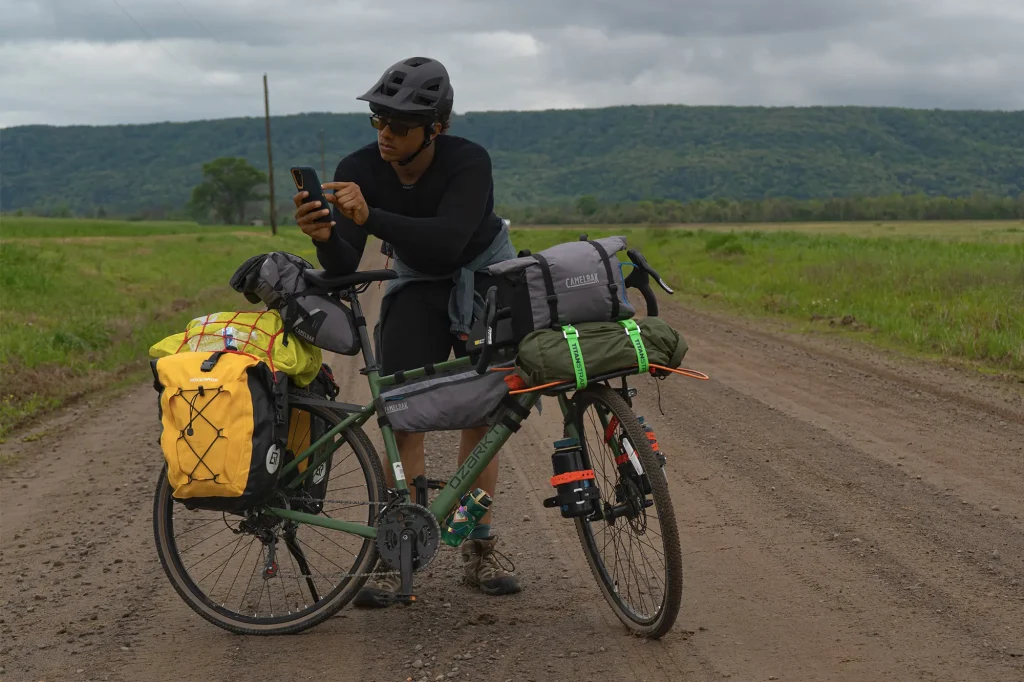
Choosing the right navigation app can make or break your bikepacking tour. You want something reliable, easy to use, and packed with features that suit your adventure style.
But with so many options out there, how do you know which one fits your needs best? In this guide, you’ll discover simple tips to pick the perfect app that keeps you on track, saves you time, and helps you enjoy every mile.
Keep reading to find the navigation tool that will become your best ride companion.
Key Features For Bikepacking Navigation
Choosing the right navigation app is important for a smooth bikepacking tour. The app should help you find your way and keep you safe.
Look for features that work well offline, save battery, and are easy to use on the road.
Offline Maps And Gps
Bikepacking often takes you to places without internet. Offline maps let you see routes without a connection.
GPS works with offline maps to track your position in real time. This keeps you on the right path.
- Download maps before your trip
- Check map detail for trails and paths
- GPS should work without mobile data
Route Planning Tools
Good apps let you plan your route ahead of time. You can add stops and choose the best paths.
Look for tools that allow route editing and saving. This helps you adjust plans as needed.
- Draw or import routes easily
- Set waypoints for rest or refuel
- Save routes for offline use
Real-time Tracking
Real-time tracking shows where you are on the route. It helps avoid getting lost.
Some apps share your location with friends or family. This adds safety on long trips.
- Track your speed and distance
- Share location with trusted contacts
- Get alerts for route changes
Battery Efficiency
Bikepacking tours can last many hours or days. Apps should use little battery to last long.
Look for apps that work well in low power mode and reduce screen use.
- Enable battery saver features
- Use offline maps to reduce data use
- Turn off unnecessary notifications
User Interface And Ease Of Use
The app should be easy to read and use while riding. Simple menus and clear maps are best.
Look for large buttons and simple controls. This helps you focus on the road.
- Clear fonts and icons
- Quick access to maps and routes
- Simple setup and offline download

Credit: bikepacking.com
Popular Navigation Apps For Bikepacking
Choosing the right navigation app is important for bikepacking tours. Good apps help you find routes and stay on track.
Many apps offer maps, route planning, and offline use. Here are some popular options for bikepacking.
Komoot
Komoot is known for easy route planning and detailed maps. It works well for bikepacking and outdoor adventures.
The app offers offline maps and voice navigation. You can customize routes based on your skill level.
- Turn-by-turn voice navigation
- Offline maps for remote areas
- Route planning with elevation info
Ride With Gps
Ride with GPS is popular among cyclists for detailed route tracking. It helps you plan and follow routes easily.
The app supports offline maps and live tracking. It also lets you share your routes with friends.
- Custom route creation and editing
- Offline map downloads
- Live tracking and route sharing
Gaia Gps
Gaia GPS is great for detailed topographic maps. It is used by hikers and bikepackers alike.
The app offers many map layers and offline use. It helps you explore backcountry routes safely.
- Topographic and satellite maps
- Offline map availability
- Route planning and tracking
Maps.me
Maps.me provides free offline maps for many countries. It is useful for bikepackers traveling to remote places.
The app lets you download maps and navigate without internet. It includes points of interest and hiking trails.
- Free offline maps worldwide
- Navigation without internet
- Points of interest and trail info
Strava
Strava is popular for tracking bike rides and sharing with others. It records your speed, distance, and route.
The app offers route creation and challenge features. It is good for those who want to track their progress.
- Detailed ride tracking
- Route creation and navigation
- Community challenges and sharing
Compatibility With Devices
Choosing the right navigation app for bikepacking means checking if it works well with your devices. Compatibility affects how smoothly you can use maps and routes.
Different devices have unique features and limits. Understanding these helps you pick an app that matches your gear and riding style.
Smartphones
Smartphones are popular for navigation because most apps support iOS and Android. They offer touch screens and internet access for live updates.
- Check app store compatibility (Apple App Store or Google Play)
- Ensure GPS works offline if you ride in remote areas
- Look for apps that save routes to your phone’s memory
- Consider battery usage, as navigation apps can drain power fast
Dedicated Gps Units
Dedicated GPS units offer reliable navigation without needing a phone. They often have better battery life and rugged designs for rough conditions.
| Feature | Smartphone | Dedicated GPS Unit |
| Battery Life | Short to medium | Long |
| Screen Size | Varies, usually larger | Smaller but brighter |
| Durability | Low | High |
| Offline Maps | Depends on app | Usually included |
| Price Range | Low to medium | Medium to high |
Smartwatches
Smartwatches add convenience by showing directions on your wrist. They sync with your phone for route info and notifications.
- Check if your watch supports the navigation app
- Battery life may limit long rides
- Small screen size means simple maps and alerts
- Good for quick glances without stopping

Credit: www.thenxrth.com
Safety And Emergency Features
Choosing the right navigation app for bikepacking tours can help keep you safe. Apps with safety features allow quick help in emergencies. They also help your friends or family know where you are.
Look for apps that offer live location sharing, SOS alerts, and weather updates. These features help you stay prepared and connected on your trip.
Live Location Sharing
Live location sharing lets others track your position in real time. This feature is useful if you get lost or face trouble. You can choose who sees your location for privacy.
- Share your location with trusted contacts
- Set automatic updates intervals
- Stop sharing anytime to protect privacy
- Use GPS accuracy settings for better tracking
Sos Alerts
SOS alerts send an emergency message with your location to chosen contacts. Some apps allow you to send alerts silently. This feature can save time when you need urgent help.
| Feature | Description | Benefit |
| Automatic SOS | Triggers alert if you stop moving for a set time | Helps if you are unconscious or injured |
| Manual SOS | Send alert by pressing a button | Allows quick call for help |
| Custom Messages | Pre-written texts with your info | Saves time in emergencies |
Weather Updates
Weather updates keep you informed about conditions on your route. Sudden rain or storms can be dangerous during bikepacking. Good apps send alerts about changes in weather.
- Get daily weather forecasts
- Receive severe weather warnings
- Check temperature and wind speeds
- Plan your stops based on weather info
Cost And Subscription Models
Choosing the right navigation app for bikepacking depends on cost and subscription types. These factors affect your budget and app features.
Understanding different payment options helps you pick the best app for your trip and needs.
Free Vs Paid Versions
Free navigation apps offer basic features without cost. They are good for simple routes and short trips.
Paid versions provide advanced tools like offline maps and detailed route planning. These apps can improve your bikepacking experience.
- Free versions limit map details and offline use
- Paid versions add extra maps and features
- Some free apps include ads, paid apps often do not
Subscription Benefits
Subscriptions give access to new features and regular updates. They keep apps current with the latest maps and tools.
Many apps offer monthly or yearly plans. Subscriptions may also include customer support and cloud backups.
- Access to premium maps and data
- Regular app updates and bug fixes
- Priority customer support
- Syncing routes across devices
One-time Purchase Options
Some apps let you pay once for full access. This avoids monthly fees and offers lifetime use.
One-time purchase is good if you want to avoid ongoing costs. It usually includes all app features at purchase.
- Pay once, use forever without extra fees
- Full access to all features and maps
- No need to renew subscriptions
- May lack future updates or support

Credit: www.reddit.com
User Reviews And Community Support
Choosing the right navigation app for bikepacking tours depends a lot on user feedback. People who use the apps share their experiences online. This helps new users make smart choices.
Community support is also important. Active user groups can answer questions and offer tips. This support can improve your overall experience with the app.
App Ratings And Feedback
Check app stores for ratings and user comments. Ratings show how well the app works for many people. Read feedback to learn about any problems or special features.
- Look for apps with high ratings and many reviews.
- Read recent reviews to get current opinions.
- Note any common issues mentioned by users.
- See if users praise the app’s ease of use or accuracy.
Active User Communities
Strong user communities help solve problems fast. They share routes, tips, and advice for bikepacking tours. Find forums, social media groups, or app-based chats.
- Reddit bikepacking forums
- Facebook groups for bike travelers
- Discord servers for outdoor navigation
- Official app user forums and support pages
Support And Updates
Check how often the app receives updates. Regular updates fix bugs and add features. Good support means developers listen to users and improve the app.
| Support Aspect | What to Look For |
| Update Frequency | Monthly or quarterly updates |
| Bug Fixes | Quick fixes reported by users |
| User Help | Responsive customer service |
| New Features | Useful additions based on user needs |
Tips For Testing Navigation Apps
Choosing the right navigation app is key for a smooth bikepacking tour. Testing apps before your trip helps avoid problems on the road.
Try different features and check how each app fits your needs. This saves time and stress during your adventure.
Trial Periods
Many navigation apps offer free trial periods. Use these to explore the app’s functions without paying.
During the trial, test map accuracy, offline use, and ease of route planning. This shows if the app suits your style.
- Check if offline maps download correctly
- Test voice directions and alerts
- Plan routes and save waypoints
- See how user-friendly the interface is
Simulated Routes
Simulate your planned route using the app before your tour. This helps find problems early.
Follow the route on a small test ride or use the app’s simulation mode. Look for wrong directions or missing paths.
- Try different terrains and road types
- Check if the app updates routes in real time
- Note how the app handles route changes
- See if the app warns about hazards
Backup Plans
Always have a backup navigation plan. Apps can fail due to battery, signal, or bugs.
Test how the app works alongside other tools like paper maps or a second app. This keeps you safe if one app fails.
- Download routes and maps for offline use
- Carry a paper map of your route
- Use a second navigation app as backup
- Practice switching between tools quickly
Frequently Asked Questions
What Features Matter Most In Bikepacking Navigation Apps?
Key features include offline maps, route planning, GPS accuracy, and battery efficiency. These ensure reliable guidance on remote trails and help avoid getting lost. User-friendly interfaces and customizable waypoints also enhance the experience.
How Important Is Offline Capability For Navigation Apps?
Offline capability is crucial for bikepacking as it ensures navigation without cellular service. It allows access to maps and routes in remote areas, reducing the risk of losing direction and enhancing safety during long tours.
Can I Use Free Navigation Apps For Bikepacking Tours?
Yes, many free apps offer essential features like offline maps and GPS tracking. However, paid apps often provide advanced tools, better map details, and enhanced reliability, which can improve your bikepacking experience.
How Do I Choose Navigation Apps For Different Terrains?
Select apps with detailed topographic maps and customizable routes for varied terrains. Look for apps supporting elevation profiles and trail types to match your bikepacking route’s difficulty and environment.
Conclusion
Choosing the right navigation app for bikepacking is crucial. Think about your specific needs. Offline maps can be essential in remote areas. Check the app’s battery usage to avoid issues. User-friendly interfaces make navigation easier. Don’t forget to read user reviews for real insights.
Test different apps before your trip. This helps in finding the best fit for you. Your adventure depends on reliable navigation. Make your selection wisely. Safe travels and happy bikepacking!